NCCC has spent more than half a century protecting the North Cascades, and although there are now many more big areas of dark green on the maps than there were when NCCC started, the job is far from done. NCCC would like to see some areas “re-wilded” – places that suffered heavy cutting during the great subsidized logging binge of 1950 – 1990, when road after road was punched deep into then-wild valleys of the National Forests in the Cascades. Some of these roads provide valuable recreational access today, but most are nothing more than crumbling corridors of destruction intruding into once wild places.
– Photo by Kevin Geraghty
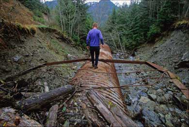
These roads were built on the cheap, with many short cuts were taken during construction. Instead of having proper rock bases, they are usually full of stumps and other organic material which is now rotting away. They simply were not built to last. They get little or no maintenance today. All are decaying, some slowly, some rapidly, with some already long gone. All of them, even ones that appear to be mostly gone, are subject to periodic blowouts and debris flows, some of them quite spectacular. This is causing great harm to rivers and fish.
NCCC would like to see many of these collapsing roads closed and decommissioned, un-doing mistakes of the past, removing the “fingers” which jut into otherwise wild places, places that could be wild again.
The map of the North Cascades has been shaped by the decisions of the past, in the days when the Forest Service was determined to push roads deep into the heart of the then-wild Cascades. Timber was king in the Forest Service, and the plan for the trees was to cut them down, not just some of them but pretty much all of them. Before World War II, most logging was done via railroads, in low valleys such as the Sauk, Skykomish and Snoqualmie. After the war came the truck logging era, and the Forest Service started pushing roads deep into areas which until then had been pristine wilderness. Up and down the range, valley after valley was roaded.
This was the era of “Wilderness preventative logging.” A roaded valley was essentially taken off the table for consideration as Wilderness or any other kind of protection. Once the timber interests had it, it was theirs. The Forest Service road budget ran into hundreds of millions of dollars every year, in days when dollars went a lot farther than they do today. The common pattern was to build a road for miles through old growth forests to reach and log a small area near the head of a valley, after which the rest could be logged at leisure. The Whitechuck valley west of Glacier Peak is a prime example – one square mile of high-elevation forest was logged at the end of the road built through 20 miles of pristine forested valley there in the early 70s, purposely to exclude the entire valley from consideration as Wilderness, which by definition is roadless.
Between 1945 and 1985, the map of the North Cascades changed from big expenses of green to a spaghetti bowl of roads in many places. Large core areas were protected in the North Cascades National Park and in various Wilderness areas, but most of that acreage was high country, and (with some notable exceptions,) contained very little in the way of lowland “big tree” forests. Many Wilderness areas looked, and still look, like a starfish or an octopus on maps, with protection extending outwards along high ridges, with the valleys in between roaded and excluded from Wilderness. The politics of the day precluded protection of many forested valleys, which were either logged or held in reserve for future logging by the then more influential timber industry.
Philip Fenner photo
Valleys are the life-filled, biologically rich parts of the Cascades, and NCCC rejects the notion that once a valley is roaded, it must stay that way forever. Many upper valley roads have already been made impassible by erosion from river course changes (most valley roads were built in floodplains, at many points right beside rivers on steep, unstable banks) and by catastrophic storm flood events, such as those in 2003 and 2006, which cut off many west-side Cascade logging roads.
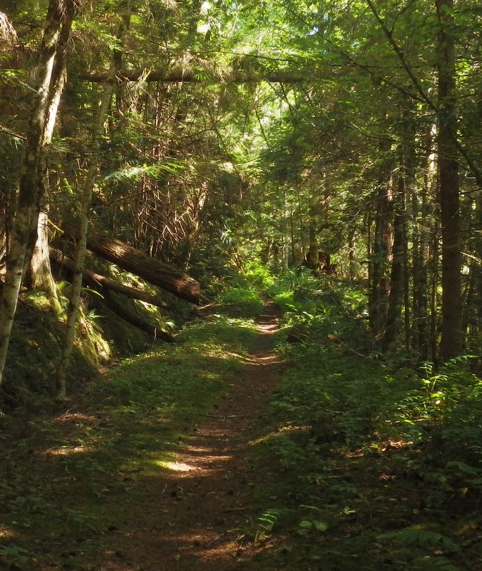
These unplanned road closures are a reasonable place to start when considering which roads to allow to revert to trails. Hikers lost many miles of trails to roads during the heyday of road building, so road closures are opportunities to regain some of this mileage by allowing the cut-off portions of roads to revert to trails, which they do with remarkable speed here. The sort of trail one gets when a road reverts is the ideal trail for younger and older hikers who cannot always hike rougher, steeper trails – improving access to the wild lands of the Cascades for many, not hindering it.
We think the time has come to “give back” some of the low elevation valleys of the Cascades and let them be more wild again. Some very successful examples are the (former) last few miles of the Phelps Creek road to Spider Meadow, and the (former) last mile of the Suiattle River road, closed when Glacier Peak Wilderness was expanded in 1984, both of which have nicely reverted to trail, adding relatively easy hiking paths for those who cannot do the steep, rugged trails that are more common in the North Cascades.
Trees grow rapidly in the North Cascades, and forests often recover well if logged only once, and not replanted with artificially selected and grown “supertrees.” Almost none of the railroad logged areas were replanted, and today many have grown back into naturally regenerated, mature second growth forests, some now with trees more than 150 feet tall and 3 or more feet in diameter. Places which could once be appreciated only by connoisseurs of ugliness are now beautiful again, and these forests are well on their way to becoming old growth.
Valleys such as the Middle Fork Snoqualmie, the North Fork Skykomish and parts of the Sauk, once vast clearcuts, are now carpeted in green. Most of the postwar truck logging occurred at higher elevations, and those areas will take longer to recover than the RR logged valleys. But even those forests are slowly regreening, and many valleys and hillsides which were horribly pockmarked 20 or 30 years ago are looking much better than they did then. It’s time to leave them alone and let them heal.
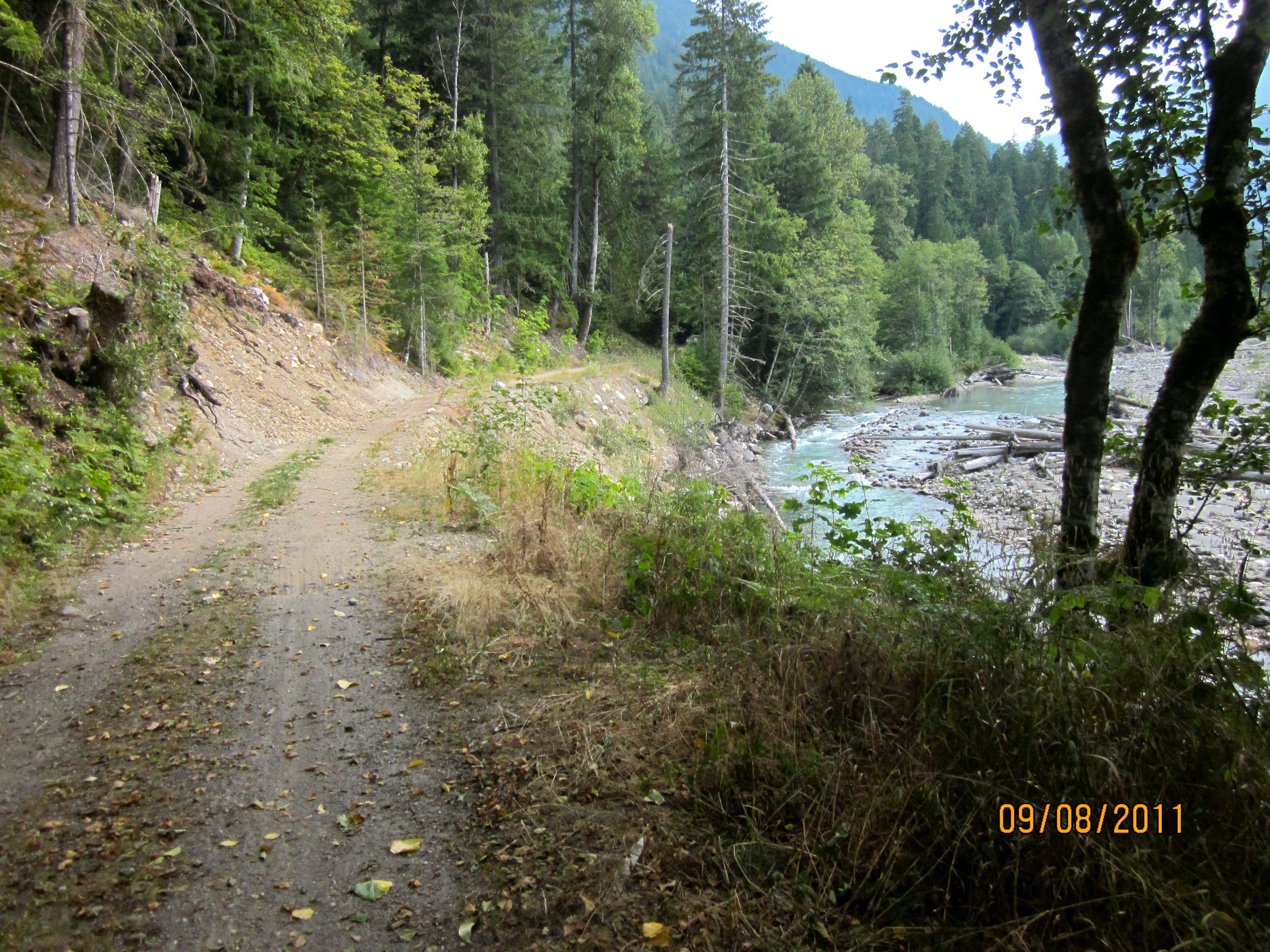
Some of the valley roads which penetrate deeply into the North Cascades have already been decommissioned, or will likely soon be. The Middle Fork Snoqualmie road above Dingford Creek has been converted into a multi-use trail for hikers, mountain bikes and horses, turning a miserable road into an attractive lowland trail. And after numerous washouts and tenuous repairs, the Park Service has finally realized that keeping the upper Stehekin River road open is a losing battle, and has decided to decommission the upper part of it.
Signed into law in 2008, the Wild Sky Wilderness takes in what was once the upper 1.3 miles of the North Fork Skykomish road, and is now a lowland trail, creating an opportunity for several loop hikes. It also protects a number of other places, such as the upper Rapid River, where old roads have crumbled away and closed themselves. Many of those who worked on Wild Sky are most proud of the low elevation lands that are now within its borders, including over 6000 acres of mature natural second growth forests and 25 miles of salmon spawning streams – all of it “re-wilded” country.
NCCC is proposing that the Whitechuck River road, obliterated in several places by a severe flood in October 2003, be decommissioned and turned into a multi-use trail along the lines of the Middle Fork Snoqualmie. The Forest Service has given up on patching together the uppermost part but needs to do more. There are a number of other valleys and other areas which NCCC believes should be considered for re-wilding. Each one needs to be looked at individually, the pros and cons weighed, but the list of candidates is long. The Forest Service is acutely aware of the problem from a funding standpoint – you can read our report on their “Sustainable Roads” initiative.
– Ed Henderson photo
On the Mt. Baker Snoqualmie National Forest,
the list might include, from south to north:
- White River – West Fork White River, Eleanor Creek, Huckleberry Creek
- North Bend – the “Garcia” road south of I-90
- Skykomish – East Fork Miller River, Money Creek, Evergreen Mountain, San Juan Hill, Harlan Ridge
- Verlot – Canyon Creek and Tupso Pass, Green Mountain, Mallardly Ridge, Deer Creek, Coal Creek
- Darrington – Squire Creek, Sloan Creek, Clear Creek, Straight Creek, Circle Creek, Tenas Creek, Grade Creek, Whitechuck River
- Mt. Baker – Illabot Creek, Sibley Creek, Bacon Creek, Anderson Creek, South Fork Nooksack, Middle Fork Nooksack, Canyon Creek, Wells Creek, Ruth Creek, Twin Lakes
NCCC is not calling for all the above roads to be closed completely, but believes they should be considered for at least partial decommissioning, along with hundreds of lesser spur roads.
Just closing failing roads isn’t enough, though. Steps need to be taken to insure that the public can visit and enjoy these public lands we all own. Many new trails can and should be built in places that are not at the end of long, crumbling logging roads. It is far better, and far cheaper to build new trails in accessible places than to continually rebuild roads in places where they will always fail. NCCC has for decades been the undisputed leader in advancing practical and realistic trail proposals for the North Cascades.
Many attractive new trails could be built in more accessible parts of the North Cascades, some of them quite easily. Some trails first proposed by NCCC, such as Beckler Peak in the Skykomish area, have now been built. Others, such as Frog Mountain in the Skykomish, and Garfield Balconies in the Middle Fork Snoqualmie, are in the planning stage. Many more are proposed, and hopefully some will be transit-accessible in future.
Of the thousands of miles of roads carved throughout the North Cascades, relatively few serve any real need. The time has come to re-wild some parts of the Cascades, and create new ways for people to enjoy these places at the same time.
For more information, email us at rewilding@northcascades.org